![]() Background analysis:
Background analysis:
In 1987, a British salvage company discovered that a shipwreck named Rheinburg had sunk in the Yangjiang and Taishan waters of Guangdong. They worked with the Chinese government to salvage the sunken ship. In November 1989, the Sino-Japanese joint investigation team discovered the sinking of the Nanhai No. 1 ship on the west bank of the Pearl River Estuary. From the discovery in 1987 to the successful salvage of the water "South China Sea No. 1" in 2007, this process has witnessed the development of the underwater archaeology from scratch, and from weak to strong in China. Underwater archaeology mainly includes prospecting of ruins and ancient tombs, underground and underwater cultural relics, and the dating of the remains, etc. Due to natural, man-made and other reasons, coupled with the complex underwater environment, large area, lack of advanced technology, underwater archaeology is very difficult. Currently, underwater archaeology is generally carried out by means of geophysical prospecting technology Multi-beam sounding system, shallow formation profiler, side scan sonar and high-precision magnetometer are the main underwater archaeological geophysical exploration technology equipment. In the pre-examination of underwater archaeology, the multibeam bathymetric system is generally used to detect the suspected targets on the seabed. The side scan sonar is also an important equipment in underwater archaeology, which can detect the characteristics of the seabed micro-geomorphology and is suitable for the detection of small or damaged antiquities. The high-precision magnetometer is another important equipment for modern underwater archaeology, which is mainly used to detect the ferromagnetic antiquities. Micro-magnetic basic sensors are mainly based on the principle of GMI effect, which can detect seabed or seabed magnetic anomalies through the sea layer and stratum, and can also locate and survey the presence and location of underwater artifacts.
Both traditional sonar and video scanning have limitations. For example, video needs to be illuminated in the depth of 15m underwater. The sea water is cloudy; the cultural relics may be covered by undersea mud and sand. The video effect is undesirable. At the same time, the undersea topography is more complicated, and the sonar imaging also has limitations. Guochuang high-precision micro-magnetic basic sensor can sidestep the defects. It can reliably function in bad weather.
![]() Principle:
Principle:
The magnetic anomaly target contains materials or currents with ferromagnetic characteristics (such as iron, cobalt, nickel, etc.), and the magnetic field strength is inversely proportional to the target distance cube, H∝M/R3. We use Guochuang Micro-magnetic Basic Sensor Array to detect the magnetic anomaly information caused by the ferromagnetic target, and determine the feature information of the ferromagnetic target according to the corresponding model algorithm.
![]() Technical solution:
Technical solution:
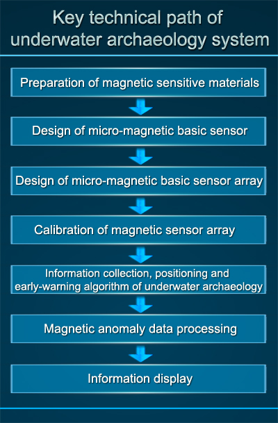
The underwater archaeology system is mainly composed of several Guochuang Micro-magnetic Basic Sensor Array s as the core equipment, and manufactured as a detection system for underwater ferromagnetic metal antiquity relics.

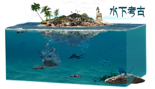
Underwater Archaeology

![]() The main components of the system:
The main components of the system:
1. The underwater archaeology system is composed of micro-magnetic basic sensor array, communication module, digital signal unit, etc.;
2. The micro-magnetic basic sensor array is installed on the archeological instrument;
3. Related algorithms include: micro-magnetic basic sensor array calibration, installation error calibration, carrier interference suppression, environmental noise suppression, processing of magnetic anomaly targets small signal, etc.;
4. Data center: collection of data and information such as micro-magnetic basic sensor array data and magnetic anomaly early warning positioning signals;
5. Terminal controller: display the working status and early warning information of the underwater archaeology system.
